UPDATE: A tornado watch has just been issued for Tennessee, Arkansas, and Mississippi counties from Sunday evening until Monday morning around 1:00 a.m.
SUNDAY MORNING UPDATE: Much of the News Channel 3 viewing area was under a Severe Thunderstorm Warning this morning. Those began to expire around 6:15 a.m. The rest of the area was under a Severe Thunderstorm Watch, which was canceled at 8:20.
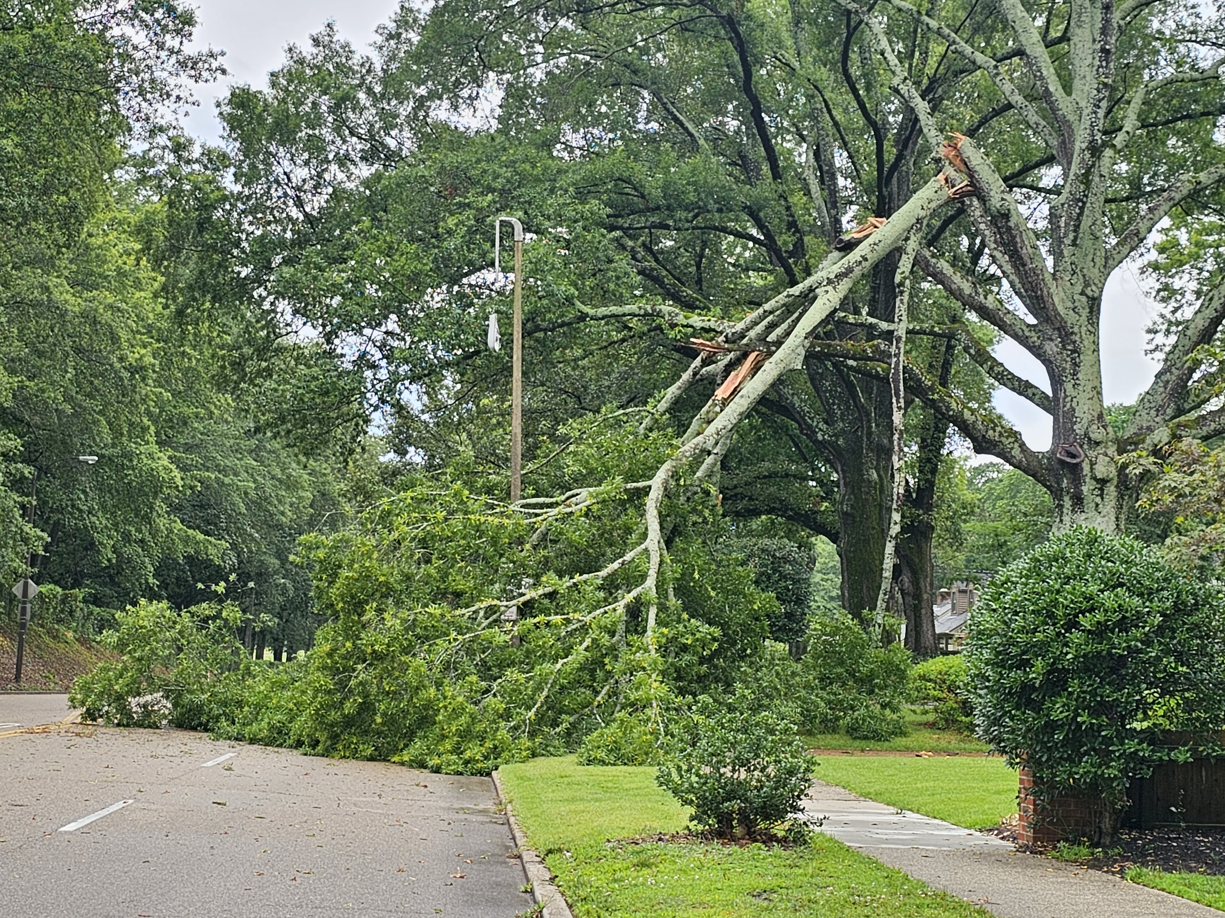
WREG is checking on reports of damage. There are limbs down and traffic lights out in Memphis.
Our reporter is headed to Hernando, Mississippi, where the mayor reports damage possibly due to straight line winds. WREG will keep you updated.
In Shelby County, MLGW said that 44,000 customers were without power after the storm, but by mid-morning that number was down to 27,000.
Winds in the storm reached 65 mph.
MEMPHIS, Tenn. — Sunday might not be a great day for grilling out — storms and some potentially severe weather are forecast to roll through the Memphis area on Father’s Day.
Round One will be over our area around 5 a.m. Sunday, and will move eastward across the river. WREG Weather Expert Wendy Nations says the main threat will be damaging winds, and some large hail is possible.
We get a break in the weather as skies clear in the afternoon, but showers are expected to develop again between 7 p.m. and midnight, Nations said.
Clouds will stick around for much of the day. Rainfall totals of half an inch to more than 1 inch are possible.
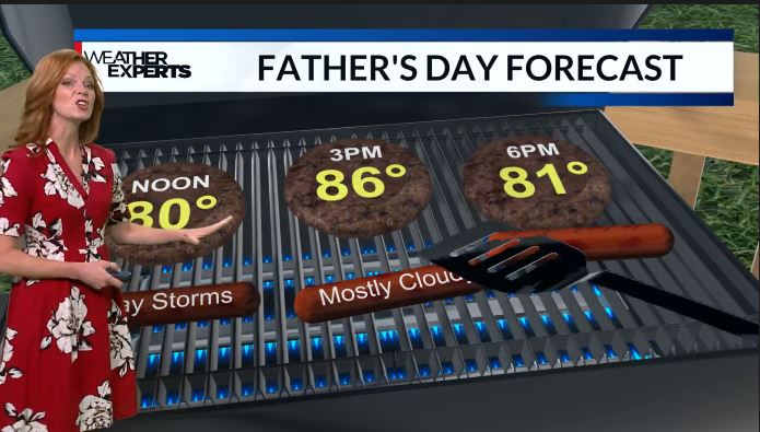
The National Weather Service has most of our area in the Marginal to Slight risk areas for severe weather Sunday, although the south and west portions of our viewing area in Arkansas and Mississippi could be in the Enhanced Risk zone.