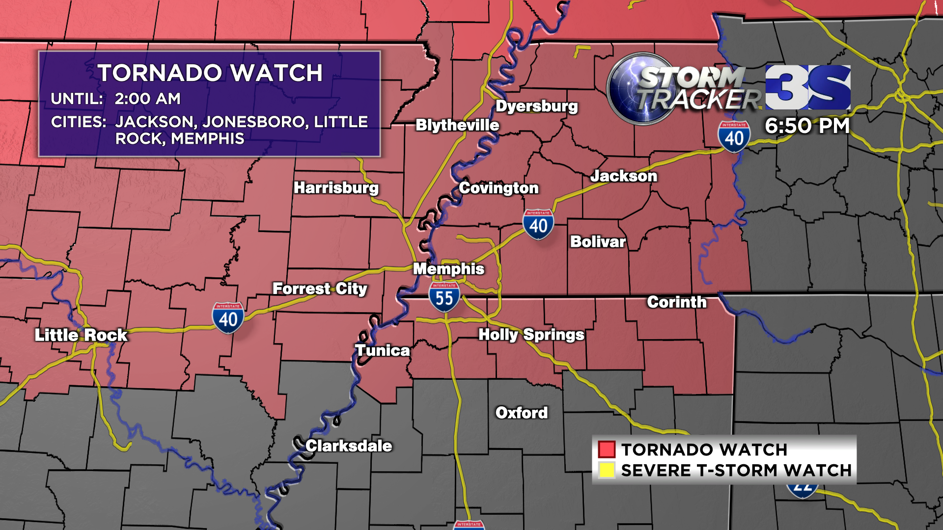
MEMPHIS, Tenn. — A TORNADO WATCH is now in effect until 2 AM.
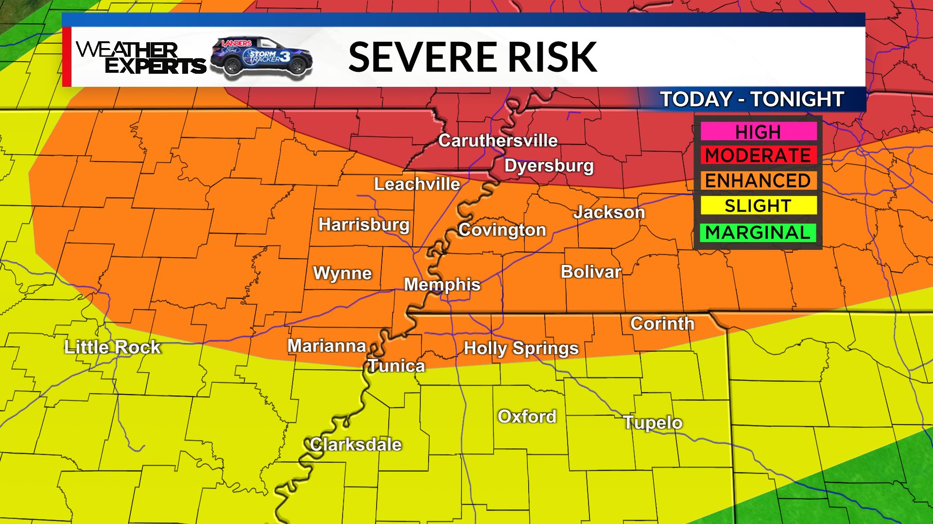
A heightened risk for severe storms Friday evening as much of the Mid-South is in either a level 3 or 4 (out of 5) on the threat scale.
Late Friday afternoon, scattered storms will start building across northern Arkansas and will head our way through the evening. Timing for the Memphis Metro is roughly 6-9pm (areas in eastern Arkansas a bit sooner). Storms will clear out to the east after midnight.
There is quite a bit of energy built up in the atmosphere for these storms to flourish and they’ll present us with a large hail and damaging wind threat. That being said, a tornado or two is still possible – especially to the north closer to the Missouri Bootheel.
These storms could absolutely affect your plans if you are going to SmokeSlam or Memphis in May this evening. Please stay weather aware!
Saturday will be a much quieter day, and by far the better of our two weekend days. Expect warm temperatures near 90 and quite a bit of afternoon sunshine! Scattered showers and storms will return after sunset Saturday, followed up by another round of scattered storms on Sunday.