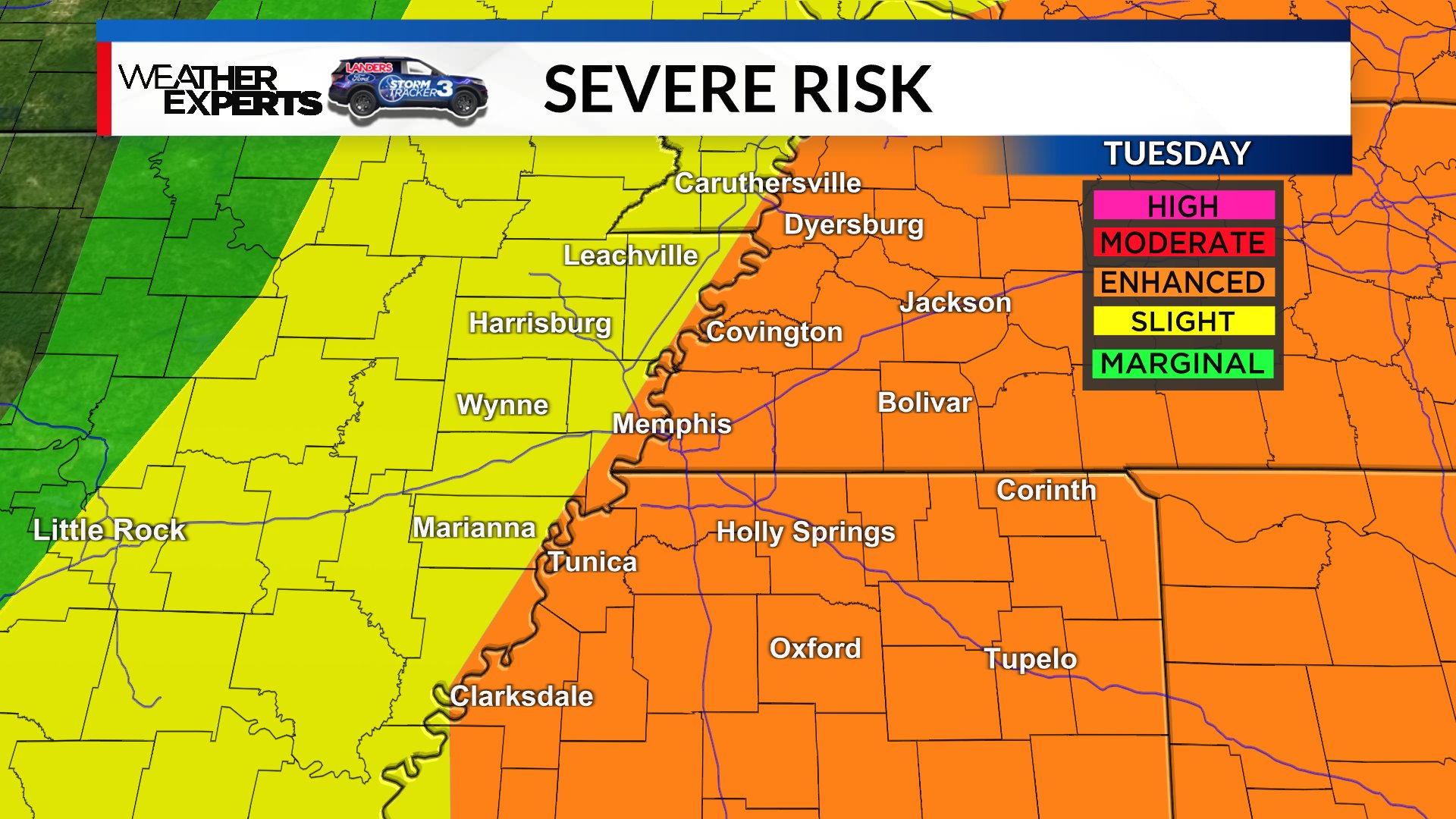
MEMPHIS, Tenn. — After a late night/early morning round of storms winds down Tuesday AM, there will be a window of a few hours for the atmosphere to destabilize once more – setting us up for another elevated risk for severe weather in the afternoon (roughly 12pm-7pm). Not everyone will see storms, but for those that do, large hail, damaging winds, and a tornado or two will be possible.
A cold front will sweep through Tuesday night, and a much more pleasant airmass with lower humidity will settle in over the region through the end of the work week.
Download the WREG Weather APP, stay tuned for updates, and stay alert for rapidly changing conditions, especially Tuesday afternoon in the Mid-South.